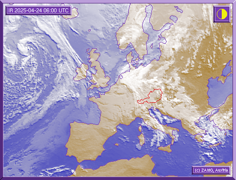
Weather Arlberg

Weatherforecast

An area of low pressure swiftly extended from France to Central Europe. It would be nice if it left as quickly as it arrived! It will not do us this favour, however! It will remain here and we will have to wait for it to clear. We will thus get an unstable spring day.
This unsettled, showery weather will be only short-lived! On Sunday a weak ridge of high pressure will bring sunny spells and slightly warmer temperatures. Unfortunately, this high will also be only short-lived and the next cold front will arrive here on Monday.
morning, 29.03.2025
 2°C/36°F
 10%
 1900m
afternoon, 29.03.2025
 4°C/39°F
 10%
 1800m
Sunday, 30.03.2025
 7°C/45°F
 50%
 2300m
Monday, 31.03.2025
 5°C/41°F
 30%
 2000m

Satellite picture

On the satellite photograph you can see the extended-range weather situation over Europe. The picture shows how the weather will develop in the next hours. If you are planning a ski tour or an off-piste excursion, please observe the developing weather situation on our satellite picture.

Here you can recognise important information on the extended-range weather situation and study the development of bad weather fronts. It is also important not to forget to seek further vital information about the avalanche warning stages before you undertake a trip into the backcountry!